
Exploring the Far Reaches of the World
Exploring and understanding the extreme ends of the world has always been a challenging and dangerous endeavor, and it has only grown more so as weather patterns shift with the changing climate. SSPI’s Better Satellite World campaign and This Planet’s on Fire, the podcast of the Climate Sense campaign, both explore this issue in greater detail:
Uncovering the Hidden Arctic
Sponsored by

with additional support from

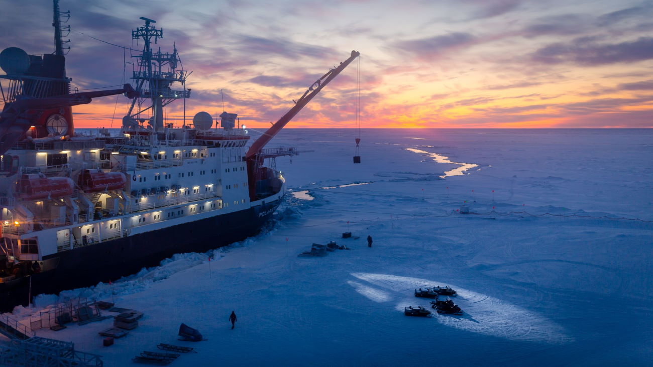
The Arctic. Bitterly cold, crossed by blinding storms and shrouded in darkness half the year, it is a place of legend where polar bears roam and gigantic icebergs plunge into the sea.
But the Arctic is changing. The six years ending in 2019 were the warmest ever recorded. As our climate changes, ice sheets on land shrink and ice covering the sea breaks up. Frozen lands change shape as permafrost in the soil melts. The Arctic is warming twice as fast as the rest of Earth and the changes are accelerating.
While the rest of the world fears rising sea levels, the warming Arctic is opening new shipping routes that promise to cut travel times. New fishing grounds will help feed the world, and new mineral deposits may supply the next generation of electric cars and wind turbines. Yet the hazards of the Arctic remain. The more people who journey there, the greater the risks to life, health and commerce.
That’s why a company called Kongsberg Satellite Services or KSAT is working to monitor Arctic weather and sea ice from space. They use a technology called Synthetic Aperture Radar that can see through darkness and clouds and accurately measure features on the sea surface and terrain, like the gaps separating ice and sea. It gives governments, cruise lines, and energy companies timely information about icebergs and shifting coastlines to prevent shipwrecks and speed journeys.
For more than 20 years, KSAT has been providing detection of oil spills from space, turning satellite images into actionable data in 120 minutes or less. That fast detection means less impact on the environment and lower costs for clean-up. Read More
Satellite Tools
In this podcast, we hear from Dr. Heather Lynch, Professor of Ecology and Evolution at Stony Brook University in New York and Chris McCormick, Founder and Chairman of PlanetiQ/Global Weather & Climate Solutions. Dr. Lynch and Chris join SSPI’s Lou Zacharilla to talk about how satellites are used as tools for a range of important aspects of the climate, including weather and ecology, which are the main focus of the conversation.
This podcast is the seventh and final episode of This Planet’s on Fire, the podcast of the Climate Sense campaign. The series was made possible with the support of SatSure.

Header photo by Stefan Hendricks, Alfred Wegener Institute. Used under Wikimedia Creative Commons Attribution-ShareAlike 4.0 International license.